A thorough knowledge of subsoil is needed for many projects: building and infrastructures construction works, assessment and search for underground natural resources, environmental diagnosis, studies for site decontamination, natural hazard assessment.

Geophysical investigation methods are used alongside geologic studies and mechanical boreholes to characterise the subsoil. The goal is to determine the nature and the geometry of geologic strata, their compaction, fracturing or alteration state, the presence of heterogeneities, uneven structures, cavities…
Geophysics allows us to cover great surface areas or long distances in an economical way. It also means collecting many samples for a given site. This can be done at surface level or using boreholes

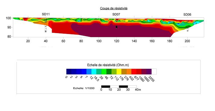
The end result of a geophysical campaign is a geophysical model of the field which, after calibration with geologic data from field observation and mechanical soundings, leads to the creation of a geologic model of the subsoil.
Geophysics applies all of the principles of physics on subsoil. Method choice depends on the type of subsoil and phenomena we are trying to characterise.
INNOGEO uses many geophysical methods:
Seismic refraction and tomography for seismic velocities
Cross-Hole and Down-Hole Tests
Electromagnetic soundings EM31, EM34, EM38…
Magnetometry
…

